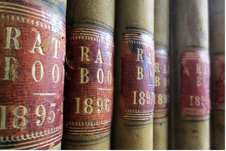
Rate books

Information from Waitaki District Archive is available. The data has been compiled by volunteers from the Oamaru Branch of the New Zealand Society of Genealogists from sources in Waitaki District Archive.
Oamaru Borough Council Rates 1880 -1920
Oamaru Borough Council Rates 1880 -1920 data has been compiled by volunteers at the Archive from the Oamaru Borough Council rate books. It includes the year, surname, forename, riding, block, section, description and who paid.
Oamaru Borough Rates 1880 to 1920
You can find the historic block and section numbers of property in Oamaru using the historic map linked to here Plan of the town of Oamaru [electronic resource] F. Fairburn, assistant surveyor, August 22nd 1860.
Waitaki County Council Rates 1878-1900
Waitaki County Council Rates 1878-1900 data has been compiled by volunteers at the Archive from the Waitaki County Council rate books. It includes the year, valuation number, riding, surname, forename, Owner, section, block, District, paid by, date of payment and additional notes.
You can find links to historic maps of Waitaki on our Maps and Plans page or search for online maps using the National Library of New Zealand's Cartographic Collection.
Disclaimer This data is provided for reference only. By publication of this data, Waitaki District Archive supplies the data in these files ‘as is’ and does not guarantee the accuracy or completeness of the data, its suitability for any particular purpose and will not be liable or held responsible for any errors, omissions or failure to provide the data. Please e-mail us at archive@waitaki.govt.nz if you identify any errors in the data or have any suggestions.